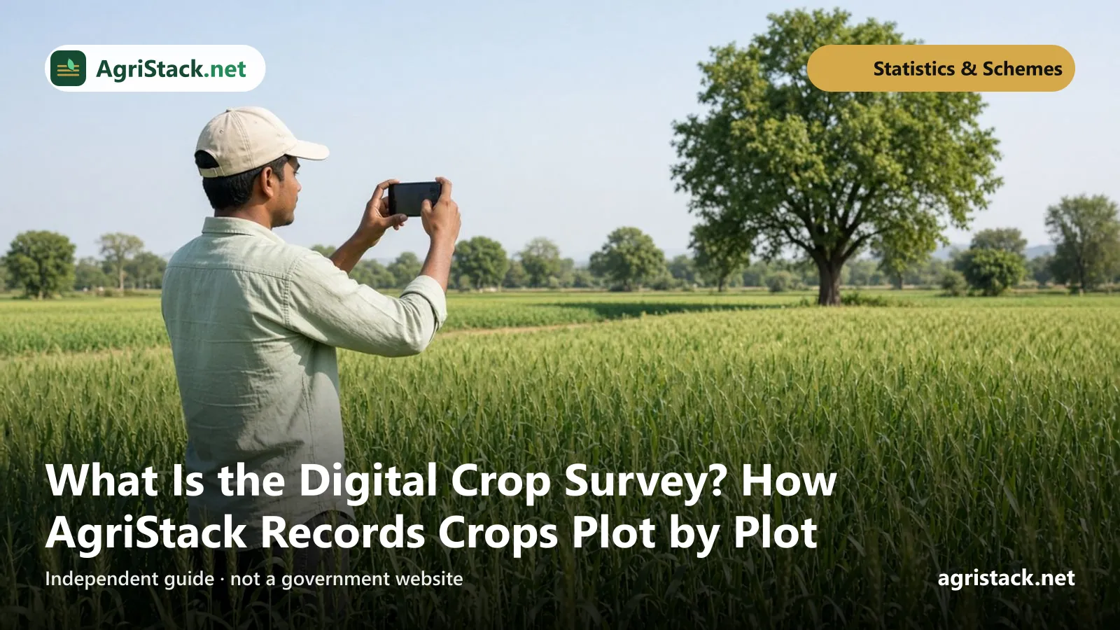
The Digital Crop Survey (DCS) is how AgriStack records which crop is grown on each farm plot, every season. A surveyor, or in some states the farmer, stands in the plot, records the crop in a mobile app and takes a photo tagged with the location. The results build the Crop Sown Registry, one of AgriStack’s three foundation registries.
It replaces the old practice of crops being written into paper registers by the village official, often from memory or estimates. This guide explains how it works, the official coverage figures, and why it matters to you.
The Farmer Registry answers “who is the farmer and which land is theirs?” and gives a Farmer ID once. The Digital Crop Survey answers “what is growing on this plot this season?” and is repeated every season.
Where it fits in AgriStack
AgriStack has three foundation registries, all built and kept by state governments:
- Farmer Registry: farmers, linked to their land records, each with a Farmer ID.
- Geo-Referenced Village Maps: digital maps showing each plot’s location on the ground.
- Crop Sown Registry: what is grown on each plot, season by season, filled through the Digital Crop Survey.
The national AgriStack website describes the Crop Sown Registry as a registry “of crops being sown and grown across the country every season, on every farm by each farmer”. It says the aim is to replace “previously prevalent paper-based methods of surveying crops” with “smartphone and image-based (including drone and satellite images in the future), more fool-proof methods of crop survey”.
The survey depends on the maps: a surveyor can record “wheat on plot 123” correctly only if the app knows where plot 123 is. See AgriStack village maps.

How the survey works in the field
Details vary by state, but the general process is:
- Before the season, the state loads plot boundaries and land record details into the survey app.
- Plots are assigned to surveyors, usually village by village.
- The surveyor goes to each plot. The app records the GPS location, so the entry is tied to where it was actually made.
- They record the crop (and details such as irrigation, where the state asks for them) and take a photo with the app's camera.
- Entries are checked by supervisors before being accepted.
- The verified data goes into the Crop Sown Registry for that season.
The Government’s India Stack Local directory describes Maharashtra’s DCS app in the same way: “Mobile-based geo-tagged field survey by authorized surveyors”, “Digital capture of crop, irrigation, and location data” and “Data validation and supervisory verification”.
Can farmers record their own crop?
In some states, yes. Maharashtra runs a farmer self-survey programme called e-Pik Pahani. Its app, E-Peek Pahani (DCS), is published on Google Play by the Department of Revenue, Government of Maharashtra. The listing says it lets farmers record their own crops, trees on field boundaries, and current or permanent fallow land, with latitude and longitude. The Nanded district website lists a state help cell for the project: 020-25712712.
Other states may have different arrangements. Ask your agriculture office whether farmers can record or check their own crop.
Download crop survey apps only through links on official state websites, and check that the publisher is the state government department. Do not install apps sent through WhatsApp links. See fake AgriStack websites and apps.
How it differs from the old crop inspection
Before digital surveys, crops were written into land records by the village revenue official during a crop inspection, called girdawari in many northern states, with the crop column of records such as Maharashtra’s Form XII serving a similar purpose. That system had well-known weaknesses:
| Old paper inspection | Digital Crop Survey |
|---|---|
| One official for many villages, so many plots were not visited | Plots assigned in the app, so coverage can be tracked |
| Entries often made from memory or the previous season | Entry made in the plot, with GPS location and photo |
| Hard to check later | Supervisors can review entries and photos |
| Records on paper, slow to compile | Data available for the season quickly |
| Used mainly within the revenue department | Can be shared, with consent, for procurement, insurance and relief |
The digital survey does not end the role of village officials. In most states, they or surveyors appointed by the state still carry out or supervise the work.
Crop seasons and timing
Surveys are done season by season, so the same plot may be recorded two or three times a year:
- Kharif: crops sown with the monsoon, such as paddy, cotton, soybean and pulses.
- Rabi: winter crops, such as wheat, mustard and gram.
- Zaid or summer: short crops between rabi and kharif, where grown.
Each state sets its own survey window, usually some weeks after sowing so the crop can be identified in a photo. Ask your village agriculture or revenue official when the window opens, especially if you need the record for procurement or insurance.
How big is the survey? Official figures
According to the Ministry of Agriculture and Farmers Welfare:
| Season | Districts | Plots surveyed | Source |
|---|---|---|---|
| Kharif 2025 | 604 | more than 28.5 crore | PIB, 10 February 2026 |
| Rabi 2025-26 | 648 | more than 31.3 crore | Lok Sabha reply, 11 August 2026 |
The Lok Sabha reply included a state-wise table for Rabi 2025-26. The five states with the most plots surveyed were:
| State | Plots surveyed, Rabi 2025-26 |
|---|---|
| Uttar Pradesh | 5,56,88,914 |
| Madhya Pradesh | 4,81,34,982 |
| Tamil Nadu | 3,38,84,867 |
| Odisha | 3,01,09,994 |
| Rajasthan | 2,72,66,008 |
The printed total in that table (31,40,04,270) is higher than the sum of the state rows (30,62,01,769). We show the state figures as printed. See the full table and our notes on the AgriStack statistics dashboard.
How to read these numbers: A plot count is not a farmer count. One farmer may have several plots, and some plots are fallow or non-agricultural. A state’s figure also depends on its land size and the season: Maharashtra, for example, does much of its survey in kharif.
Why the crop survey matters to farmers
The Government says the Digital Crop Survey “has enabled plot-level visibility of crops and better estimation of sowing patterns across seasons, which in turn supports evidence-based planning for procurement, input supply and logistics”.
For an individual farmer, the record can matter in several ways:
MSP procurement
Where a state uses the crop survey for procurement, your crop record may be checked when you sell at MSP. The Ministry says Chhattisgarh “has institutionalized Farmer ID and Digital Crop Survey for MSP-based paddy procurement, covering over 32 lakh farmers in a single season”, improving “transparency, crop verification, and timeliness of MSP payments”. See Farmer ID and MSP procurement.
Crop insurance
Insurance depends on knowing what was sown where. Plot-level crop records can help match claims to actual crops. Check your state’s and insurer’s current rules. See Farmer ID and crop insurance (PMFBY).
Disaster relief
When floods or drought hit, knowing which crop was on which plot helps relief reach the right farmers quickly. The Ministry cited Maharashtra’s use of AgriStack for relief, including “the transfer of over ₹14,000 crore to 89 lakh farmers for Kharif 2025 crop losses”.
Better planning
Accurate crop data helps governments plan for seeds, fertiliser, storage and markets, which affects prices and supplies farmers depend on.
What you should do as a farmer
- Get your Farmer ID. The crop survey is linked to land; your Farmer ID links you to that land. See Farmer Registry online registration.
- Know your plot numbers. If a surveyor visits, or you use a self-survey app, you will need to identify your plot. See survey numbers explained.
- Ask when the survey happens in your village each season, and whether you can check the record.
- Report mistakes early, during the season, to your village agriculture or revenue official. A wrong crop on record can cause problems later at procurement or with a claim.
- Never pay anyone to “enter your crop”. The survey is a government activity.
Common questions about accuracy
What if the surveyor never came to my plot? Ask your agriculture office whether your plot was covered. Coverage is large but not complete in every district.
What if I sowed two crops on one plot? How mixed or multiple crops are recorded depends on the state’s app. Mention it to the surveyor or official so the record reflects what you actually grew.
What if my plot is fallow this season? Fallow land is also recorded. Maharashtra’s farmer app explicitly includes current and permanent fallow.
Does the photo show my face or home? The photo is of the crop in the plot. Surveyors should photograph the crop, not people.
Privacy
The crop record is linked to your plot and through it to your Farmer ID. The Ministry says AgriStack follows the Digital Personal Data Protection Act, 2023 and its 2025 Rules, that farmers’ data is collected with their consent, and that it is stored in encrypted form. Sharing with other agencies is meant to happen only with your consent. See Farmer Registry consent and data sharing.